


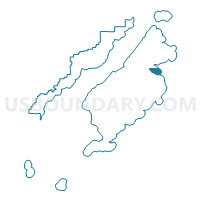
Ouzinkie Precinct, Kodiak Island Borough, Alaska
About
Outline

Summary
| Unique Area Identifier | 523423 |
| Name | Ouzinkie Precinct |
| County | Kodiak Island Borough |
| State | Alaska |
| Area (square miles) | 84.60 |
| Land Area (square miles) | 16.30 |
| Water Area (square miles) | 68.30 |
| % of Land Area | 19.27 |
| % of Water Area | 80.73 |
| Latitude of the Internal Point | 57.91027200 |
| Longtitude of the Internal Point | -152.38279170 |
Maps

Graphs
Select a template below for downloading or customizing gragh for Ouzinkie Precinct, Kodiak Island Borough, Alaska


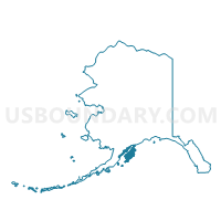
Neighbors
Neighoring Voting District (by Name) Neighboring Voting District on the Map
- Flats Precinct, Kodiak Island Borough, AK
- Mission Road Precinct, Kodiak Island Borough, AK
- Port Lions Precinct, Kodiak Island Borough, AK